Small Unmanned Aerial Vehicles (UAVs) facilitate the laborious task of land surveying.
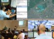
Small UAVs, or SUAVs, are a great addition to your Land Survey tool closet. They go a long way to maximize your resources and improve the methodical process of civil engineering and the land surveying process. What once took many hours, even days, of precise measuring, recording and notation, can now be done in a matter of minutes. By leveraging the use of SUAVs, combined with powerful automation and processing software, JohnsTek can provide your company with a powerful set of materials that developed in high resolution, geo referenced, 3-D and multiple spectrum images which facilitate the crew with high-end analysis of the target terrain. These products can be used for land elevation analysis, development architecture design, planning expansions, exploitation areas, construction site survey, or simply a bird´s eye view of your property for future use.
JohnsTek Inc. is ready and fully capable to respond to any client´s request with guaranteed results.
Click here for more information or click to Contact us today to discuss your particular needs!
Author: Jaime Vila @JTI_JVila (Twitter)
Jaime Vila is the General Manager for JohnsTek LATAM.
@JOHNSTEK